Satellite imagery and machine learning provide a detailed view of the maritime industry, including the number and activities of fishing trade and transport ships. Surprisingly, this data reveals far more vessels than previously reported, a significant discovery that policymakers must take into consideration.
AIS transponders allow for precise tracking of activity, but their use is not universal. Consequently, vital information such as the number of vessels fishing in a region, their operators, and the quantity of fish they are catching is often difficult to access, with a combination of local, proprietary, and government-approved numbers.
Making policy decisions is difficult and approximate due to this lawlessness in the industry. Countless ships visit restricted or protected waters or exceed safe harvesting numbers, depleting stocks quickly.
Machine learning performs millions of operations to accurately recognize and track the tens of thousands of ships at sea at any given moment.
Fernando Paolo, David Kroodsma, and their team at Global Fishing Watch, along with collaborators from multiple universities, analyzed two petabytes of orbital imagery from 2017-2021. They identified millions of vessels at sea and cross-referenced them with reported and known coordinates for vessels tracked via AIS. The results of the analysis were published in Nature.
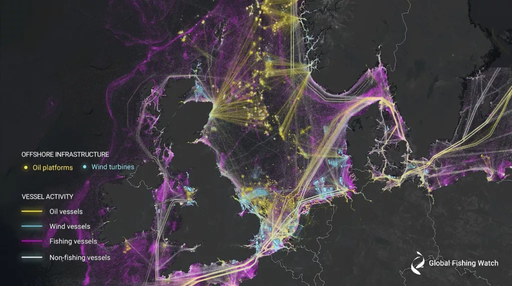
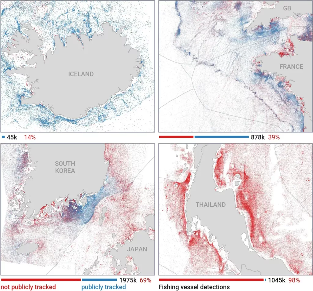
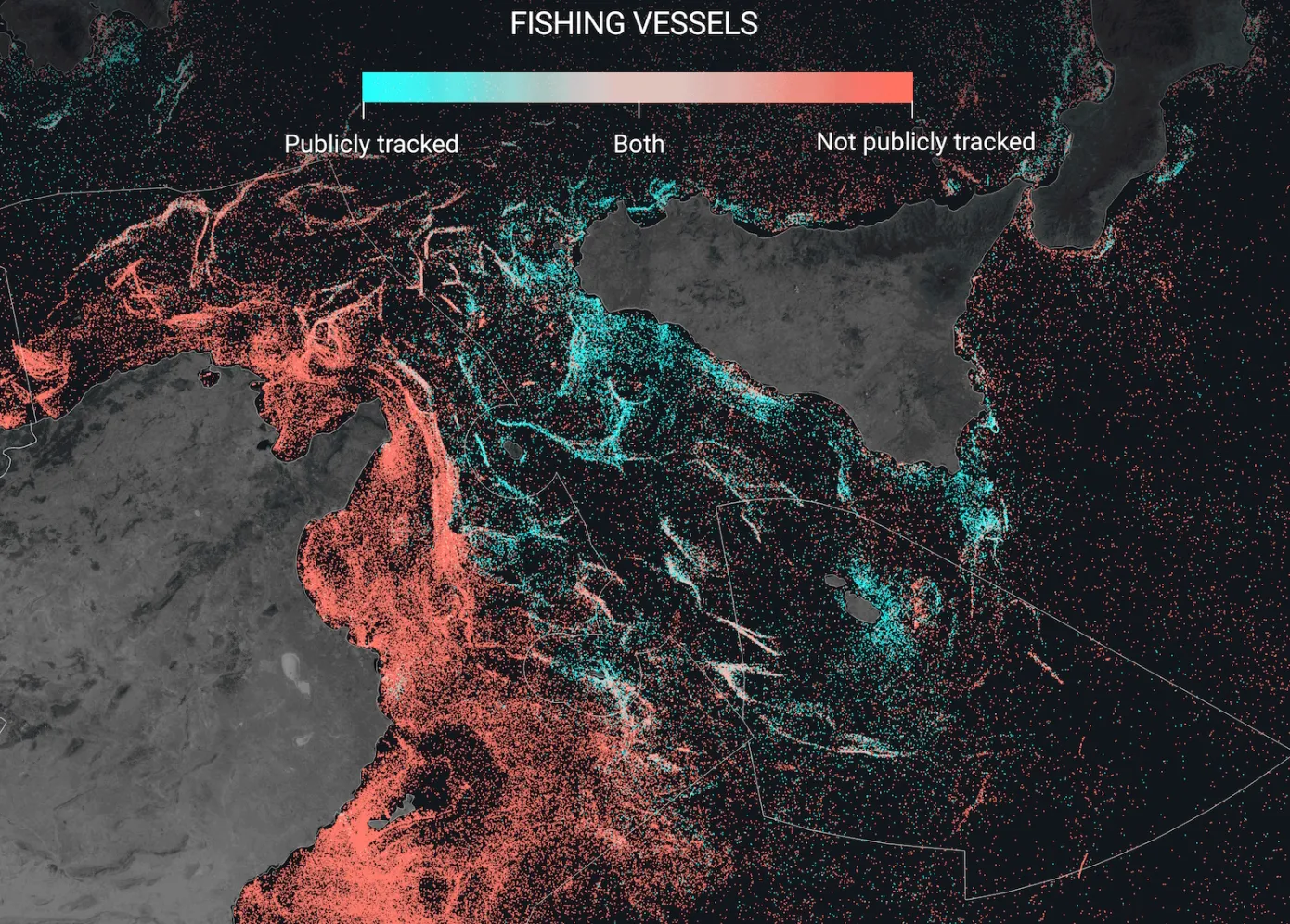
The study documents that around 3/4 of all industrial fishing vessels and almost a third of all transport and energy vessels aren’t tracked publicly. This means that the dark fishing industry is huge — perhaps as big as the documented one. The imagery also reveals increases in wind turbines and other renewable energy placements, which are difficult to track.

Paolo explained to TechCrunch that these vessels are missing from public tracking systems for a few reasons. For instance, small vessels and those operating in areas with little or no satellite coverage or AIS infrastructure, as well as those deliberately turning off their transponders or avoiding detection, all remain untracked. He also pointed out that some countries have proprietary means to track vessels within their waters.
He continued, emphasizing the limits of proprietary systems to track vessels and the need to share this information with other nations. With the growing population and warming oceans, it is essential to know this data beyond a single nation and its internal agencies. He highlighted the importance of openly tracking fishing vessels to monitor fish stocks, as fish represent a dynamic resource that tends to move around.
Paolo pointed out that it is difficult to understand and map the full ecological footprint of fishing trade vessels without all of them publicly broadcasting their positions and activities. The visualizations show that Iceland and the Nordics have the highest levels of tracking, while Southeast Asia has the lowest – down to practically zero off the coast of Bangladesh, India, and Myanmar.
The rest was in the Americas, Africa, and Oceania. We can see that a large portion of fishing is occurring in Asian waters, but due to a lack of reporting, the true amount is unknown.

Satellite data shows that only 10% of fishing trade vessels are in European waters, while 71% are in Asian waters. Moreover, China alone appears to account for 30% of the global fishing industry. This illustrates that our current understanding of the scale of the global fishing industry is inaccurate.
We must use good information to build strong policies and science, or else they will be fundamentally flawed,” said the researcher. The satellite analysis revealed that fishing trade boats were regularly present in protected areas such as the Galapagos islands, which is against international law.
In response, the researcher suggested that authorities in different regions should use the new maps to assess the situation. They must ensure that their policies and science are based on good information to avoid fundamental flaws.
Paolo highlighted the need for further investigation and protection of potentially illegal fishing in marine protected areas or restricted areas. He stated that the first version of their open data platform is still in progress, as they are continuously analyzing radar imagery from the Sentinel-1 satellite to identify activity around the world. He believes that the data collected will be beneficial in creating relevant policies.
See Also: News Related to Artificial Intelligence
Our website, globalfishingwatch.org, displays and allows access to this data, which is current up to three days ago. You can view a list of the philanthropies and individuals who support our nonprofit organization here.


